Bandelier cliff dwellings, Valles Caldera, and epic New Mexico scenery
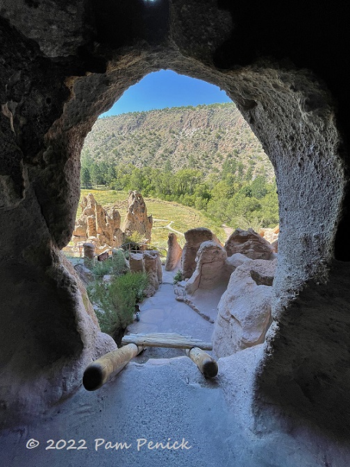
In early September, at the end of our trip to Santa Fe, New Mexico, we drove out to Bandelier National Monument. We’d last explored its ancient cliff dwellings and pueblo ruin two decades earlier, and we wanted to hike and see it again.
Bandelier National Monument
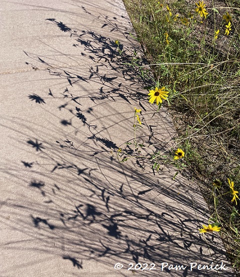
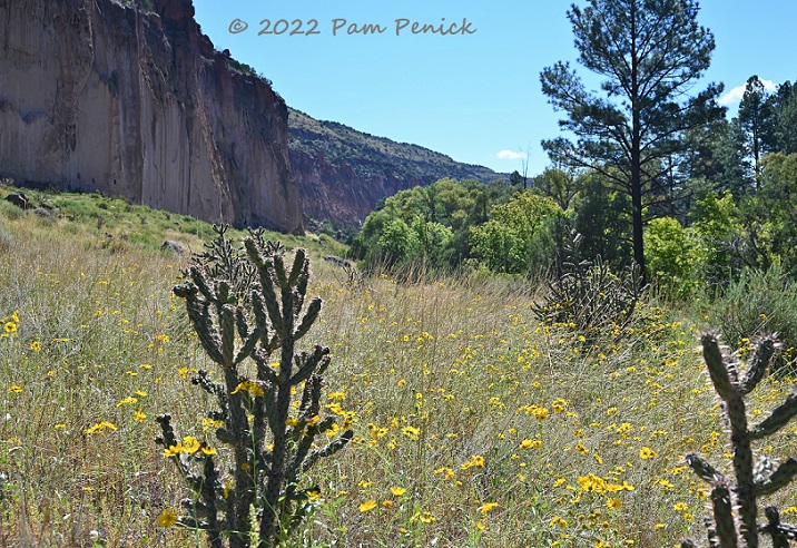
We took the scenic Pueblo Loop Trail, which winds through Frijoles Canyon and along tall cliffs of soft, volcanic rock called tuff. Late summer/early fall wildflowers were blooming along the trail.
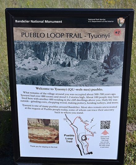
Frijoles Canyon is quietly scenic today, but approximately 800 years ago it was home to hundreds of indigenous people who farmed, hunted, foraged, and raised turkeys. They made homes and storage places in hollowed-out caves in the cliffs and built multi-story, stone-and-mud structures on the canyon floor. The park’s website offers this history:
“The Ancestral Pueblo people lived here from approximately 1150 CE to 1550 CE. They built homes carved from the volcanic tuff and planted crops in mesa top fields. Corn, beans, and squash were central to their diet, supplemented by native plants and meat from deer, rabbit, and squirrel. Domesticated turkeys were used for both their feathers and meat while dogs assisted in hunting and provided companionship. By 1550, the Ancestral Pueblo people had moved from this area to pueblos along the Rio Grande. After over 400 years the land here could no longer support the people and a severe drought added to what were already becoming difficult times.”
Today you can explore the canyon and even enter some of the caves at Bandelier, named for Adolph Bandelier, a 19th-century anthropologist whose work here drew attention to the importance of the site, eventually leading it to be preserved as a national monument.
Kivas
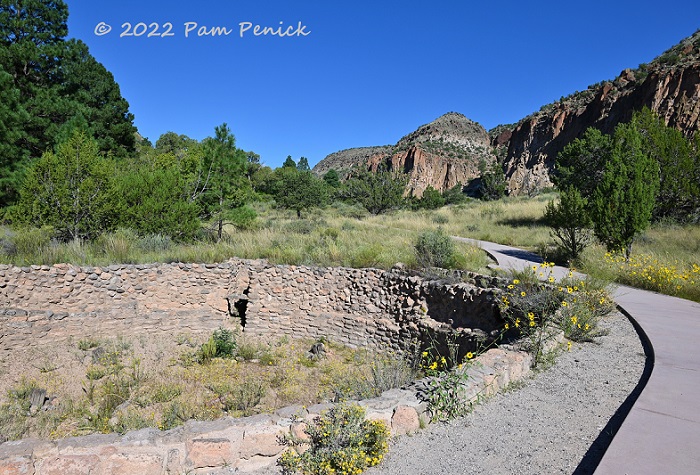
Along the trail to the cliffs you come across Big Kiva. A kiva is a circular, subterranean space for religious ceremonies or communal gatherings, accessed via a ladder in a roof made of posts and mud. The roof of Big Kiva is long gone, but the stone circle remains.
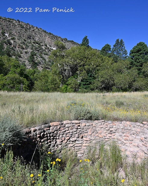
A smaller kiva has been excavated a little farther along the trail.
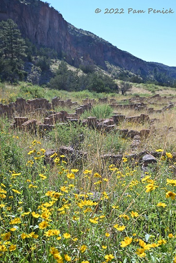
Ruins of stone block homes can be seen nearby.
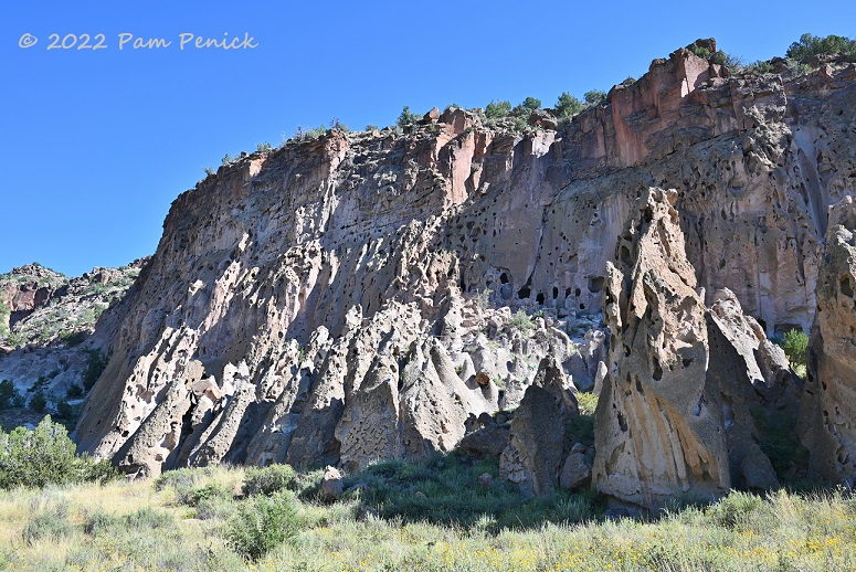
According to signage, about 100 people may have lived in houses on the canyon floor, and another 400 in cavates (pronounced CAVE-eights), or carved-out caves, in the tall cliff along one side of the canyon. In the summer they farmed on the mesa atop the cliff. Imagine scrambling to the top of that to tend your crops!
Cavates
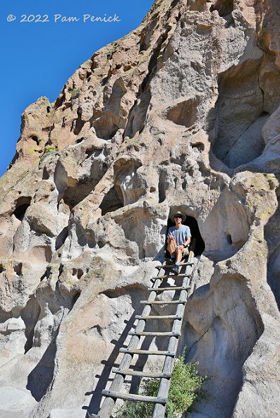
You’re allowed to enter the cavates that have ladders. A ranger told us that the native Puebloans would have made ladders out of a single pole with notches cut out for footholds, or by lashing wooden rungs to two poles. Can you imagine darting up a single-pole ladder to access your home, perhaps carrying an infant or food supplies? In all weather?
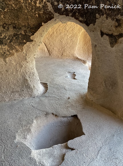
And yet they did. According to Bandelier’s website:
“Over a thousand of these rooms are located in the walls of Frijoles Canyon…Groups of these homes, cavate villages, were used by generation after generation of Ancestral Pueblo people…Gouges in the ceilings of cavates show that builders used tools such as digging sticks and sharpened stones to enlarge naturally occurring openings in the tuff. Most cavates are single rooms, but some are connected by interior doorways. Many cavates were fronted with masonry structures up to three stories high that were constructed of tuff blocks and mud mortar…These rooms were used for many things including weaving, grinding corn, and storage. Many cavates contain carved and plastered niches, probably for storing pots and household items. Sockets in the ceiling, along with anchors set in the floor, held supports for looms that were used for weaving. The cavates were also used as living quarters.”

A room with a view
Tyuonyi Pueblo
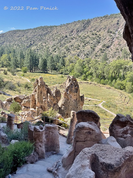
The cavates overlook the ruins below, known as Tyuonyi Pueblo.
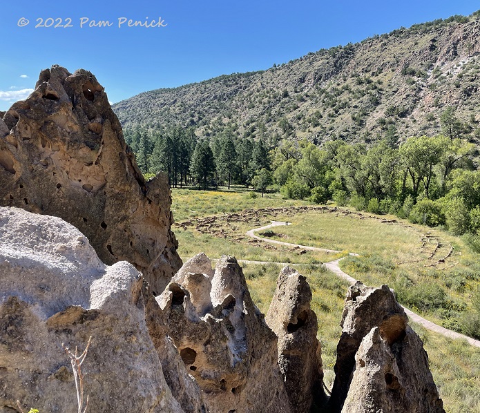
Built in a circle, the foundation ruins show where a lively village of multi-story rooms would have stood 800 years ago…
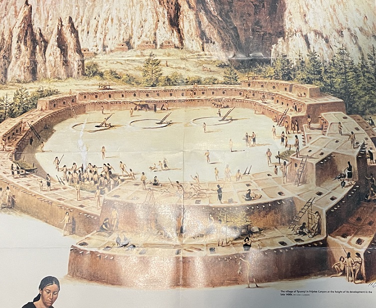
…as represented in this image from the National Park Service brochure. The circles in the center with ladders poking out of them are kivas. Against the cliff wall in the background are masonry structures fronting some of the cavates.
Talus House
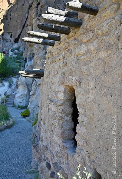
Along the cliff, Talus House is an early 1900s reconstruction of the masonry structures that would have fronted some of the cavates. It likely would not have had a window or door; the existing window is there so visitors can look inside. Rather, it would have been accessible via a ladder in the roof.
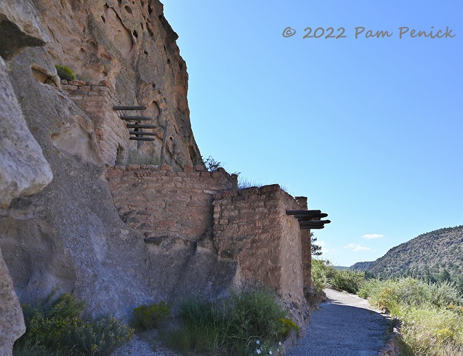
The Ancestral Pueblo people must have been adept climbers.
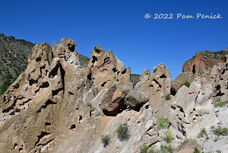
The soft and holey volcanic rock in Frijoles Canyon came from ash flows from Valles Caldera, which we visited later that day (pics below).
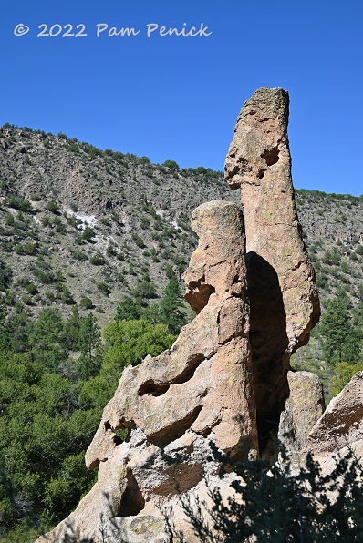
These eroded stone pillars look like people, don’t they? One is sitting, the other standing, gazing out at the canyon.
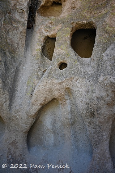
We fancied we saw a skull in one section of the cliff.
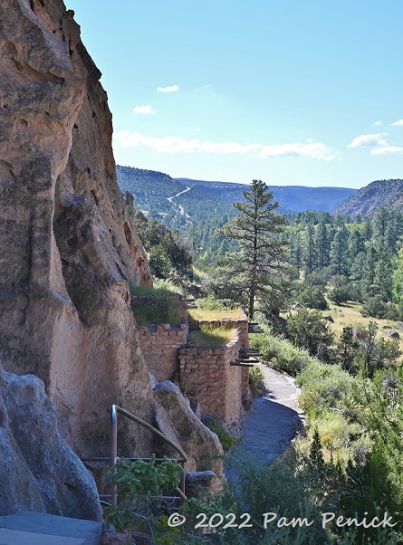
View back toward Talus House
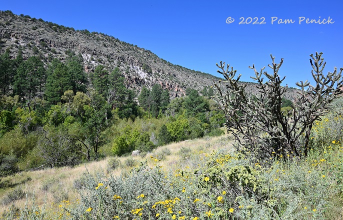
Cholla and wildflowers
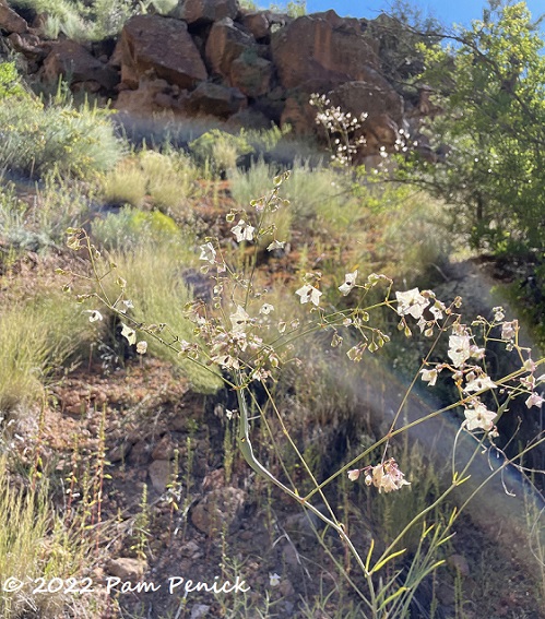
More wildflowers
Long House
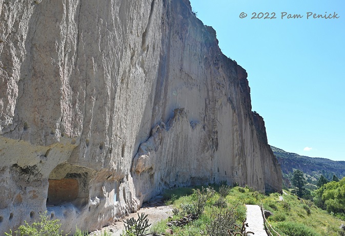
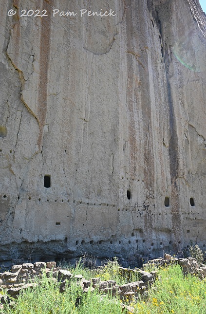
One section of the cliff shows evidence of multi-story homes built against the cliff wall. This is called Long House.
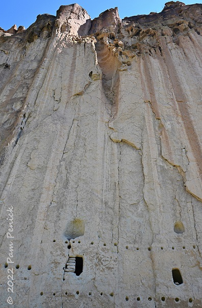
Rows of holes in the soft rock show where wooden poles called vigas once supported the roofs.
Hundreds of petroglyphs — some of turkeys and dogs — remain to this day, carved into the stone, providing evidence of how the people lived.
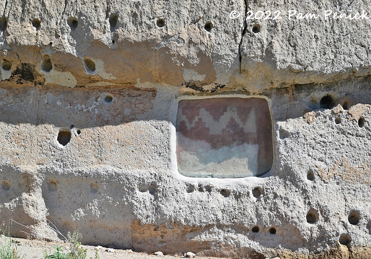
A painted pictograph survives too, now protected under glass.
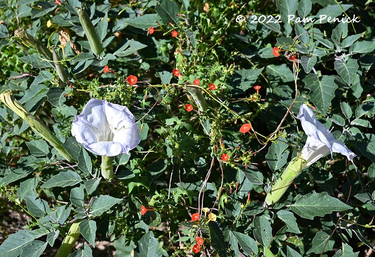
Datura and red morning glory, growing wild
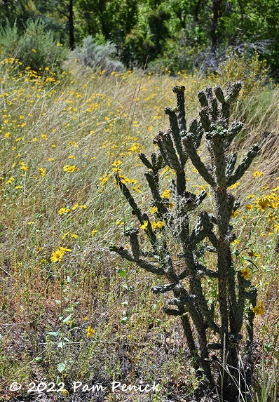
More cholla with wildflowers
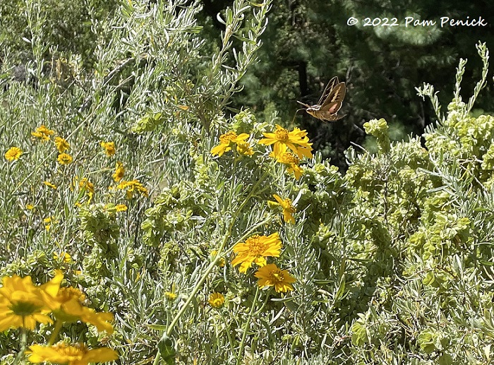
A sphinx moth wearing the same hues as the pictograph captivated me here, darting and swooping among the flowers, nectaring with its long tongue.
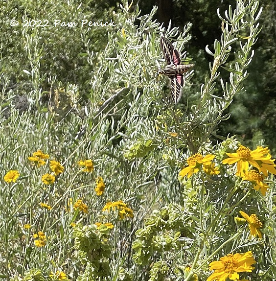
Zoom — a fly-by!
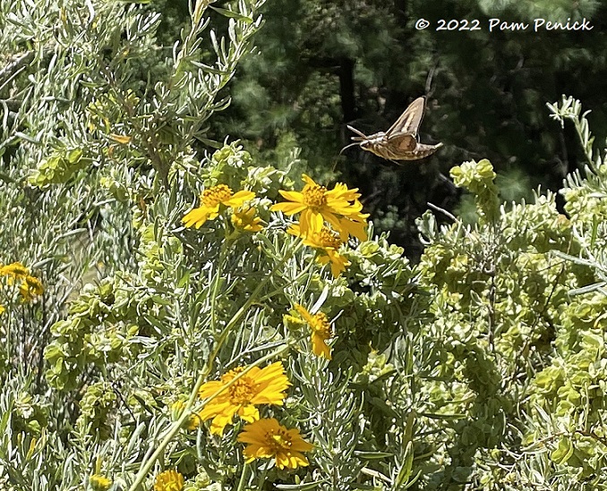
Dining on the wing
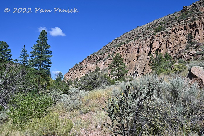
Canyon view
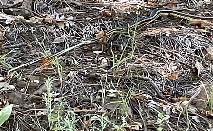
The trail continues another half-mile toward Alcove House and dips into a woodland, where we were lucky to spot this exciting cannibalizing scene. Sorry for the blurry pic taken from a distance, but that’s a larger snake on the right devouring a still-struggling smaller snake on the left. The smaller snake had locked its tail around something to try to pull away, but the bigger snake overpowered it, swallowing half before slithering away, a drooping tail dangling from its mouth.
Alcove House
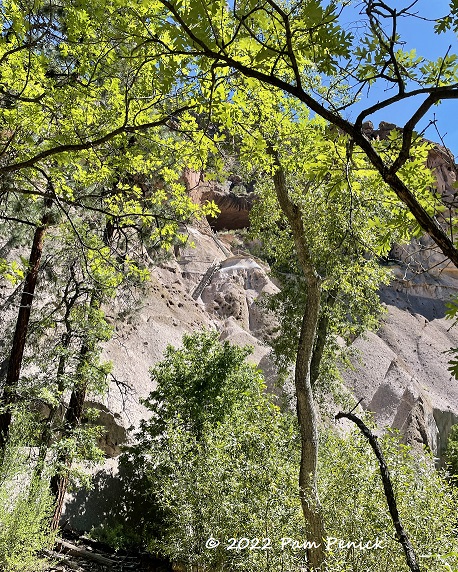
On previous visits we’d never gone as far as Alcove House, a large cave tucked 140 feet up a cliff face. David was excited to climb up to it. It’s accessible via 4 wooden ladders and stone stairs. I decided to pass, remaining below to take photos of his climb.
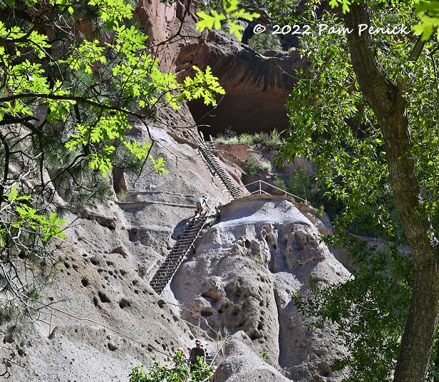
There he goes.
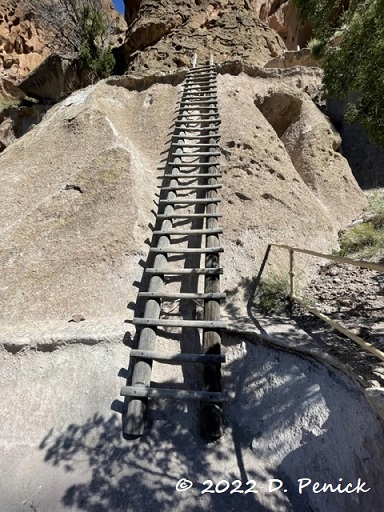
He took this photo looking up the third ladder.
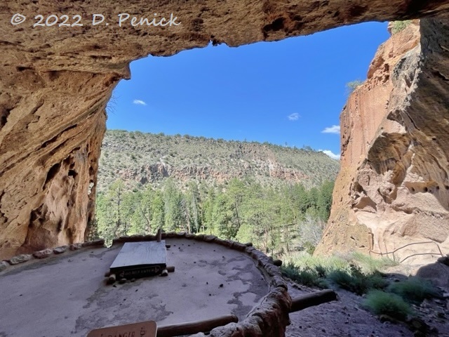
And here’s his view from inside. A reconstructed kiva sits here, and 25 people may have lived in this high cave at one time.
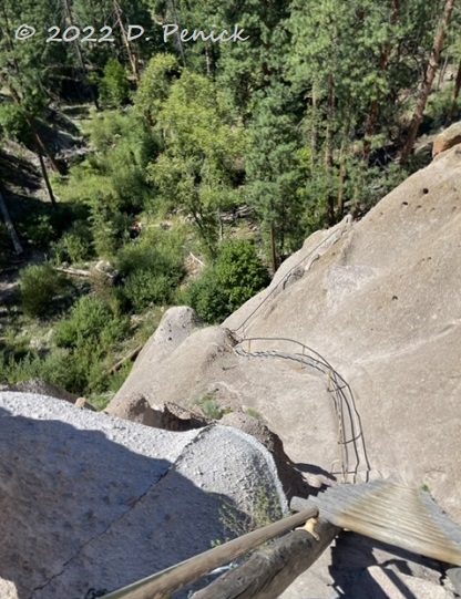
Of course if you go up, you must go down.
Valles Caldera National Preserve
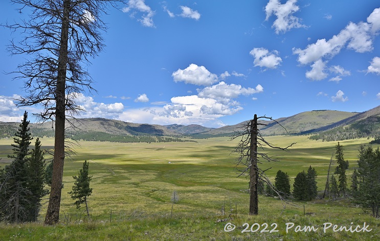
Bandelier is fascinating, and we were glad for the chance to explore it again. After a picnic lunch we drove 30 minutes west to Valles Caldera National Preserve — the origin of all the volcanic rock at Bandelier. Where once there was apocalyptic destruction, today a beautiful green valley spreads out before you.
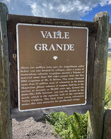
A bullet-holed sign tells the story:
“About one million years ago, the magnificent valley before you was formed by collapse, after a series of tremendous volcanic eruptions ejected a volume of material more than 500 times greater than the May 1980 eruptions of Mt. St. Helens…Minor volumes of magma, leaking to the surface as recently as 50,000 years ago, formed the dome-like hills between you and the skyline to the north, which is the opposite wall of the enormous Valles Caldera.”
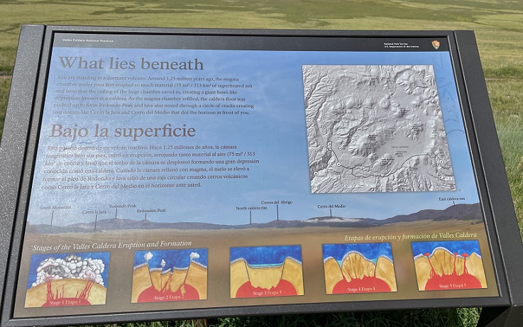
“You are standing in a dormant volcano,” a sign explains. I’ve been to a few of these in my lifetime.
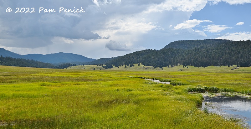
The valley grasses glowed mossy green, with moody, blue-green hills all around. It was gorgeous.
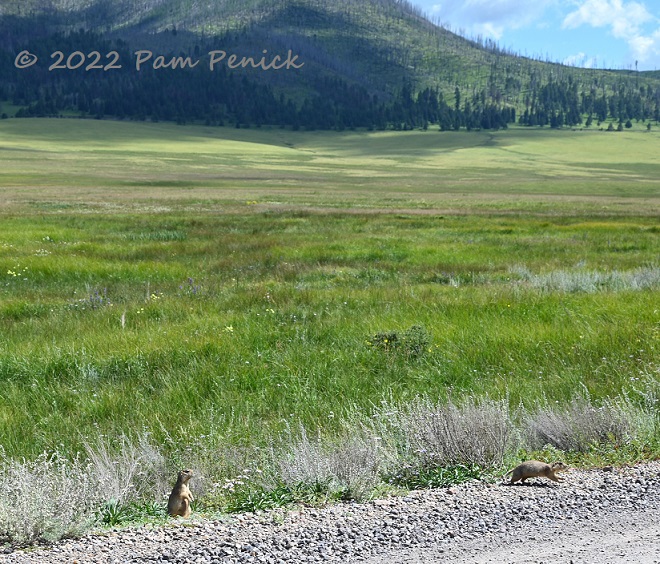
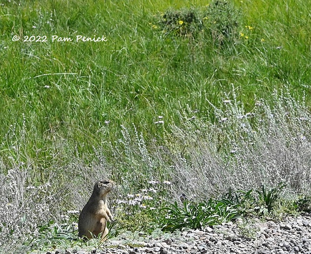
Prairie dogs make their homes here, and the cute rodents were standing up and dashing across the road while we stopped to watch them.
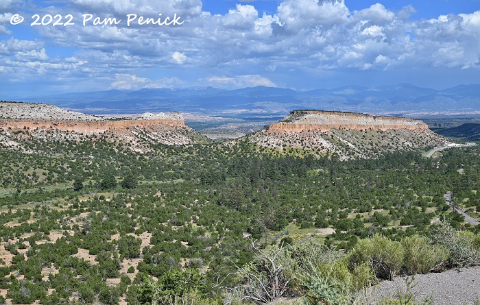
Anderson Scenic Overlook near Los Alamos
From there we drove to Los Alamos, where we discovered that every car is stopped at the entrance to town by security, asked their business there, and — when your camera is spotted on the console — told not to photograph the buildings on the right side of the road as you drive in. Okay then! I ended up not taking any photos in Los Alamos, as we simply drove through, but it satisfied our morbid curiosity to see the city where the atomic bomb was developed.
On the way out of town, heading back to Santa Fe, we came to a breathtaking view of orange mesas skirted by olive green trees, with blue mountains in the distance. We pulled over at the Anderson Scenic Overlook to take in yet another stunning vista in the Land of Enchantment, on our last day in New Mexico.
This is my final post about our end-of-summer road trip to New Mexico. To read the series, visit my post about Santa Fe Railyard Park and Farmers’ Market and work backward from there, finding additional links at the bottom of each post.
__________________________
Digging Deeper
Come learn about gardening and design at Garden Spark! I organize in-person talks by inspiring designers, landscape architects, authors, and gardeners a few times a year in Austin. These are limited-attendance events that sell out quickly, so join the Garden Spark email list to be notified in advance; simply click this link and ask to be added. Season 8 kicks off in fall 2024. Stay tuned for more info!
All material © 2025 by Pam Penick for Digging. Unauthorized reproduction prohibited.


Beautiful photos as usual (although 3 from the last section appear to be missing). It’s interesting to have a look into ancient history like that. And that one cliff face definitely looks like a skull.
Thanks for your comment, Kris. I wonder what was going on with the photos? Sometimes when images don’t all load for me, if I refresh the page, the missing photos appear.
What a beautiful and informative post, Pam. That part of the country is so fascinating!
There’s a lot to see and a lot of beauty and culture to appreciate out there. And everywhere really.
Thank you for a trip down memory lane! This is my favorite place in the world.
My pleasure, Cheryl!